Thirty three years after the Chernobyl nuclear power plant spewed a cloud of damaging radioactivity over the adjacent Soviet state town of Pripyat and the surrounding northern Ukrainian bustling forest lands, instantaneously transforming a cornucopia of life into a desolate and bizarre wasteland of genetic mutations, waves of researchers and morbidly curious individuals attempt to make sense of the carnage. In a real life heat map prompting troubling readings on the geiger counter with a heart racing frequency of clicks escalating from a single solo drumbeat to a frenzied solider attack march, the ominous and toxic presence of the volatile Cesium-137 isotope, keeps the woods nearest to the remains of the reactor uninhabitable save for a few hearty species of plants and wildlife. But the prevalence of unhealthy radio levels estimated to reach half-life a 150 years into the murky unyeioding future, has not stopped a team of British scientists from facilitating an ambitious mapping project on the lands contained within the government ordered exclusion zone, reports the BBC, a venture comprised of sophisticated drone technology, and a chilling look into the possibilty of dissecting and studying the aftermath of an actual nuclear holocaust resulting from inept diplomacy leading to catostropic warfare without suffering additional casualties.
As the frequency of drones has increased exponentially with the consumer marketplace abuzz with a dark mosquito cloud of unbridled enthusiasm and a seemingly limitless amount of choices in clogging civilian urban airspace as god knows how much data is actually reaching the coffers of Chinese servers, the search for rare positive news surrounding unmanned aerial vehicles is painstakingly arduous and rivals the 15-second news cycle abstaining from an attack on the White House and pushing identity politics onto the vast audiences of device holders. The aerial mapping of the expansive area of still red hot plausible zombie forests and ruins is a noble pursuit that will hopefully forward the collected acumen of the effects of radiation in nature, as the anti-fossil fuel campaign continues, and nuclear generators gravitate towards the forefront of the energy debate.
The critical axiom governing the harnessing of nuclear energy is that it is not a matter of if, but a matter of when the next disastrous meltdown will occur, and the discarded radioactive fuel rods from functioning facilities will always provide a complex challenge in proper and safe disposal that does not compromise ground water supplies.
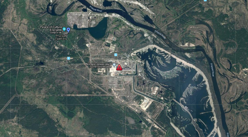
 Aerial image of the ill-fated reactor site and surrounding region. (courtesy Google Maps) In the high risk, high reward harvesting of nuclear energy, the abundance of water is a baseline requirement, as the super heated fuel rods need to generate enough steam to activate the massive turbines.
As proponents for nuclear energy utilize an abrupt 180 degree spin tactic in pushing the agenda that the evacuation and relocation of hundreds of thousands of people inadvertently created large areas now designated as official nature preserves, the Mr. Burns of the fission lobby and the pathetically adorable iconic underdog of “Blinky” the three eyed fish, are at a loss for words when the subject of health risks and mutations are introduced into the conversation. There exists debate within the scientific community as to the extent of genetic damage in larger mammals who survived to breed in the exclusion zone, a Rhode Island sized chunk of land, and proceeded to migrate into the wilds of northern Europe. While simple organisms were certainly adversely affected and altered by the radiation, the aerial drone survey campaign proactive step in exploring an active unique laboratory of the real world, but a productive use of unmanned aerial vehicles that does not involve inane voyeurism or an outlet for a weekend DIY hobbyist.
WATCH: As “Blinky” is introduced to the world.
Read the BBC story here.
VIDEO: Somber Footage Of The Abandoned Ruins Of Pripyat